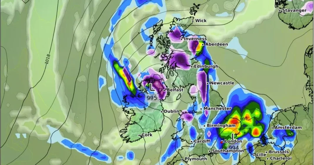
Millions of Brits could be set to shiver in surprise May snow flurries, with as many as 45 counties across England, Scotland, Wales and Northern Ireland in line for a dusting.
GFS weather model maps suggest some parts of the country could be blanketed white at the start of next month. According to the maps, the north of England and into Scotland will take the brunt of the freezing conditions. Northern Ireland is also expected to see some intense flurries. The data suggests snow could be falling at a rate of around three inches per hour in some locations on May 6.
The maps show as many as 45 counties could experience some snow, while many more face the possibility of rain hitting too. The wintry conditions are expected first in Scotland in the early hours of May 6, hitting Glasgow and Edinburgh, before drifting southward.
By 6am, the maps show intense flurries over Northern Ireland. North Wales and northern parts of England, especially around the Pennines, can expect some snow around this time too. Snow is expected to continue in northern parts of England well into the evening, the data suggests.
The Met Office’s long range forecast for April 30 to May 9 reads: “Fine, dry and very warm across the majority of the UK at the start of this period with long clear or sunny spells.
“However, it is expected to be cloudier in the far north with some rain at times. Some of this rain will likely spread southwards late next week before clearing to leave a mainly dry and sunny weekend, although with temperatures closer to normal than on preceding days.
“Into the following week, it will probably turn more changeable, with dry, settled periods interspersed with some spells of wetter weather. This will bring some showers or longer spells of rain at times, which could be heavy and thundery. Temperatures will probably be near normal.”
Next week’s conditions could barely be more different, as people can expect a new hottest day of the year set: David Oliver, a Met Office Deputy Chief Meteorologist, said: “Many can anticipate a very fine spell of weather with temperatures reaching 27C during the middle of the week.
“We are not expecting the April UK temperature record to be broken, but some locations may nudge local records. Often warm spells are driven by warmer air arriving from further south, but the origins of next week’s air are from Scandinavia and central Europe.
“This air mass will be warmed by compression as the high pressure begins to build, and this warmth will be boosted by daytime heating from the April sun.”
The highest recorded April temperature was in 1949 when Camden Square in London recorded 29.4C on 16 April.
At Reach and across our entities we and our partners use information collected through cookies and other identifiers from your device to improve experience on our site, analyse how it is used and to show personalised advertising. You can opt out of the sale or sharing of your data, at any time clicking the “Do Not Sell or Share my Data” button at the bottom of the webpage. Please note that your preferences are browser specific. Use of our website and any of our services represents your acceptance of the use of cookies and consent to the practices described in our Privacy Notice and Cookie Notice.

